Pages

Showing posts with label underground. Show all posts

Monday, 5 November 2012

Palmerston's Follies

Whether out on a boat in Plymouth Sound, walking the coastal path around Mount Edgcumbe or driving along the A38, you're not too far away from one of Palmerston's Follies, but what exactly are they & what were their purpose?

Hidden-Plymouth-Forts
Picklecombe Fort on the Western Approach of Plymouth Sound


A ring of Victorian era defences surround Plymouth in the form of impressive looking forts & gun batteries, with some sites being remodelled from earlier Napoleonic fortifications. Those built within the era of the Prime Minister at the time, Lord Palmerston, came about after fears of a French invasion as reported in the 1860 Royal Commission on the Defence of the United Kingdom. Lord Palmerston championed the idea of strengthening coastal defences & harbours around the UK. It was a costly exercise - the greatest ever spent on building fixed defences during peacetime, & by the time of completion, advances in gun technology had rendered the forts out of date. Hence they became known as Palmerston's Follies.

Hidden-Plymouth-Palmerston-Forts
Tregantle Fort - Still in active military use as a firing range


The Plymouth Defences were built with intention of defending the threat of a Naval assault by the French on Plymouth Dockyard. Any modern visitor to Plymouth via sea will often ask the question of what structures they are seeing as they enter Plymouth Sound. Picklecombe Forts lush apartment conversion greets visitors as they reach the Breakwater, where once inside, the impressive dark & daunting look of Breakwater Sea Fort & the mighty combined fortifications of Bovisand & Staddon Battery at Staddon Heights can be seen at their best. Further inland, Stamford & Staddon Forts complete the south-eastern side Reaching Drake's Island, Palmerston era additions can be seen in the form of an arc of stone casemates with protective iron shields that housed twenty-one 9 inch guns.

Hidden-Plymouth-Palmerston-Forts
Breakwater Fort

Hidden-Plymouth-Palmerston-Forts
Fort Bovisand & the earlier Staddon Heights Battery

Hidden-Plymouth-Palmerston-Forts
Drake's Island Casemates


Plymouth's Northern Defences stretch from Efford Fort all the way to Ernesettle Battery overlooking the Tamar. Sandwiched roughly in the middle is Plymouth's best preserved Palmerston, Crownhill Fort which is now utilised by businesses & wedding venue with occasional open days to the public. All of the Northern Defences are occupied with businesses or Plymouth City Council in-situ with the exception of Ernesettle Battery which is MOD, & Agaton which is a VOSA Test Station.

Efford Fort to the left overlooking the North Eastern Approaches

Cannons in-situ at Crownhill Fort

Murder Hole Ditch at Efford Fort being reclaimed by nature

Agaton Fort Gatehouse - No Access


On the Cornish side around the Rame Peninsula, coastal gun batteries & forts snake the coastline from Garden Battery at Mount Edgcumbe to Scraesdon Fort at Antony & although some were lost to demolition in the 1970's, there has been excellent works to preserve their status from current tenants who look after the structures including the Rame Conservation Trust, Mount Edgcumbe Estate, Defence Estates, Ministry of Defence & all the owners of converted sites such as Cawsand, Picklecombe & Polhawn Forts & Whitsand Bay Battery which is now a holiday park.

Hidden-Plymouth-Palmerston-Forts
Scraesdon Fort from above

Hidden-Plymouth-Palmerston-Forts
The grand stone entrance to Tregantle Fort

Hidden-Plymouth-Palmerston-Forts
Flooded moat at Scraesdon Fort

A handful of forts have suffered vandalism & theft in recent years including Bovisand & Drake's Island, which had renovation & refurbishment projects put on hold due to the recessions, but recent rumblings on the grapevine are positive & look good for the future. One things for sure If we won the lottery jackpot, we would certainly offer to buy it straight from the owner & reopen it to the People of Plymouth....a name? ooooh maybe Cultural Adventure & Heritage Centre of Plymouth....or is it forward thinking enough for the Plymouth vision of a modern city?......school trips, tourism, local produce brought to the island by boat, open days, jobs with old trade skills brought into much needed use....must...stop....dreaming! Oh & did you know that Drake's Island is actually the cap of an extinct volcano? Awesome history that Plymouth has don't you agree?

Thankfully some of the forts have been much better cared for & the conversions to apartments & holiday homes at Cawsand & Picklecombe Forts are stunning. Okay, so they may be a little out of our price range & we can't even afford a second home but we still appreciate their history & the imposing look these structures have. Polhawn Fort is now primarily a wedding venue, a place we considered for our own wedding, & in our opinion this has to be one of the best wedding venues in the South West. The time, money & priceless effort that has gone into the restoration of the fort is phenomenal & we will feature this in a forthcoming series on the blog.

Hidden-Plymouth-Palmerston-Forts
Inside one of the immaculate bedrooms - Polhawn Fort

Hidden-Plymouth-Palmerston-Forts
TV replaces the cannon - note the original racer rail for the cannon

Hidden-Plymouth-Palmerston-Forts
One of my favourite spiral staircases - stunning workmanship


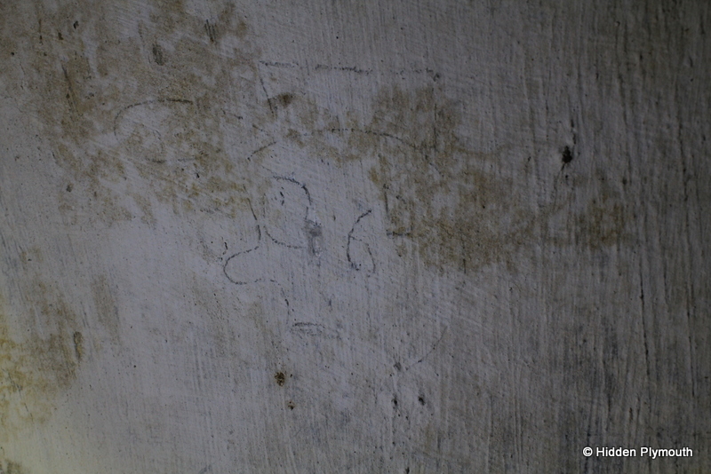
Over a series of blog posts, we will take a look at each site in detail, including the demolished gun batteries around Plymouth & the surrounding area. A strong focus point of our research will be to build a history of Military Units & stories from personnel who have their own memories of a particular site & we welcome any information of historic value. Graffiti from years back adorn many of the forts with units such as the Royal Marines, Royal Engineers, The Parachute Regiment & even the SAS. Feel free to get in touch if you recognise any of the graffiti featured in the forthcoming gallery - info@hiddenplymouth.co.uk

Hidden-Plymouth-Palmerston-Forts
1939 graffiti from a Commando veteran

Hidden-Plymouth-Palmerston-Forts
Until next time....another spiral staircase in a Plymouth Fort - we're off to see what's down there


Tuesday, 25 September 2012

"The Wall" Public Air Raid Shelter Part 2

Well you got the brief tour of the "The Wall" ARP Shelter & here we look at some of the graffiti & artefacts found within alongside a few surprises above ground. To kick off though, we want to focus on that one brick in "The Wall".

P.L.D. 10 Years 13/1/1941 


The person who etched this into the brick toilet cubicle would now be 81 years old & we are guessing it is a male. We urge all readers to check their families for the initials & help to identify the writer. Hey, we know it's a long shot but we like to search really deep for our research & build a better history for the shelters that form an important part of our heritage. We have tracked a family from other graffiti in the past, one being from the Devonport Park shelter that was partly demolished back in 2009. Writings in this shelter have given us some leads to work on including an address in Mount Gould Road.


The best we have to go on!

Any takers on this one?

Inscription found in another toilet block

One of two face drawings found close to each other

Face art

Character drawings

Mister Sad

Basketball?

Striking chin feature in this drawing

Contractor says fire engine, archeaologist says bus, we say it's a tram - How about you? Send us a comment below!

Although there was little graffiti, it was some of the most interesting. Clearly there were signs that the shelter had been whitewashed with a second coat at some point due to the way that some of the pencil markings were showing through & again highlights just how clean this shelter was. Whoever was in charge of it certainly took pride in it's appearance. Thankfully there were just a few artefacts that were left behind at various points along the underground passageways.

Artefacts found close to the entrance

Rusted, almost disintegrated bucket

Bottles from the wartime era

Bottled in Exeter

Bakealite junction boxes for electric lighting

Bench fixings void of timber seats

Bakealite fittings

Now personally for me, apart from the etched brick, the highlight was what the shelter was cut into above ground. Evidence of the Plymouth Leat was what the archeaologist's were said to be looking for & also the original cobbled surface of the car park had been revealed as see in the photos below. This shows how sympathetic the demolition has been of this shelter, a behind the scenes look at how little damage was done to the original structure itself. An escape hatch had been exposed & there were a couple of exploratory holes cut through the roof, but most impressive was the stairwell that had been throughly cleaned by contractors in preparation for the documentation to take place. 

This was always one of those shelters that would be demolished due to the need for development within the city centre, but at least it has been documented in a way that Plymothians can now see for themselves that it is not always wanton destruction of heritage. We were impressed with how thoughtful the contractors & Uni staff were toward the shelter & taking time to tell us their views on it's existence. A lot of people thought that this shelter was long demolished since the war, & it's highly possible that this was just infilled quickly & re-tarmaced before the end of the war & returned to it's use as a car park but, with all the madness of rebuilding the blitzed city it's highly possible that documents were lost along the way.

Stood atop the entrance to the shelter with Plymouth Museum in the background
Entrance overlooked by the Link & Davy Building

A different angle over the entrance

Original cobbled road that the shelter was constructed through

Stood on top of the shelter showing depth, cobbled road & contractors exploratory hole

Close up looking the cobble surface
Stood with our back to the previous image looking midway along the shelter & exposed escape hatch

Shelter looking toward the infilled end - notice the stone walls that the shelter has cut through

This section of the shelter cut through some sort of stone walling - could this be a trace of the leat?
Surveying the site stood atop the section that had yet to be uncovered fully above ground

There it is & we also made a short video tour of the shelter which will be uploaded soon for you to follow the passageways to the end. On a personal note this was an excellent shelter to document with the different layers of history around it & particularly pleased to see how the passageways cut though the cobbled road.

A lot of feedback has been received since the first photos appeared & we welcome feedback from as many people as possible, after all it is your support that will eventually lead to one of these time capsules to be saved. As we have already mentioned, many people had thought this one had long gone years ago so with the groundworks for a much needed new University building imminent, it would have suffered major setbacks if the shelter were to be kept & plans changed to adapt. Given better hindsight, if it could have been integrated into the new building as a permanent historic feature it would certainly have been one of the most interesting campus buildings in the world, food for thought!

Sunday, 23 September 2012

"The Wall" Public Air Raid Shelter - Plymouth University


Back at the end of August, we were kindly notified by one our readers of yet another ARP shelter discovery at the site of a new building to be constructed on the Plymouth University Campus & we were lucky enough to have the opportunity to document it's passageways before demolition began. After our recent wedding we didn't get to go on honeymoon so what better way to spend a few hours down one of Plymouth's WWII time capsules & we would like to thank all involved for allowing this fantastic visit to happen. Following a recent aerial photo of the site kindly posted by Matt Sayer on our Facebook page, the reaction from some readers has caused quite a stir but full of positivity in support of saving one of the remaining ARP underground shelters in Plymouth. More of that in Part 2 but firstly let's concentrate on the shelter in question & in usual fashion we had to give it a name. Ladies & gents we give you "The Wall" Public ARP Shelter.

One of the original entrances opened up, exposing the stairwell & ready to document


As soon as I heard the news, it was a short visit to the loft followed by a couple of hours digging in crates for the Air Raid Precaution Charts that we have archived & sure enough, there it was on the Sector Map, originally sited under a car park on what was then Tavistock Road. Built to accommodate 280 people, construction began in September 1939 with completion just two months later on November 7th, 1939 at an estimated cost of £105,000. It was of the arch type & designed with damage limitation in mind, with left & right angles that would act as a baffle in the event of a direct hit, & hopefully reduce the number of fatalities. Around the corner today remains the Portland Square shelter & it's memorial to the 76 people who lost their lives & without this design, there would have been much more loss of life. We took a minute's silence during documenting to pay our own personal respects for the civilians that lost their lives, something we do in every shelter we visit.


The first section of seating are within the shelter
Stood inside toilet cubicle looking back to daylight from the entrance
Walking along to the next section reveals one of the escape hatches
Exploratory holes had initially been expertly cut through the roof giving the shelter the first sight of daylight in more than 60 years, also offering us rare natural lighting conditions to work in. For the last two passageways to the other infilled entrance though it was back to using torchlight & fingertip searches of the floor for any artefacts, of which we are pleased to say we documented a handful of items of interest, the best being two old bottles made in Exeter & Falmouth.

With the escape hatch showing daylight behind us, it's a different story for the remaining sections

Rusty bench fixings, an escape hatch & toilet cubicles

Turn right & we are at the end, looking at the Tavistock Road entrance with original infill
Bottles from the wartime era - made in Falmouth on the left & Exeter  on the right

What came as a surprise was actually how clean this shelter was left after resealing it, but we're glad that somebody had the ounce to leave a few items of interest for future generations to discover. Of the little graffiti found, it was interesting nonetheless & the best of which led to the choosing of it's nickname. This was the first time we had come across a toilet cubicle with only half a wall as opposed to full height seen in the photos above. This led us to believe that this was most likely the mens urinal where buckets would have been used. It's possible that this was also used as a store for the Warden, for first aid, safety escape tools & equipment such as stirrup pumps. Sadly there was no evidence of this left behind but.....a single brick in that wall was etched with something special.

The half wall toilet cubicle looks unassuming but on one brick on the rear side  is an inscription

The answer to this is that the person may still be alive today


At this point it made us think that we need to write deeper into into the visit but we wanted to give you a good look at the shelter from within. Please keep on reading for the remainder of our findings including some humorous drawings. Until then we leave you with this fantastic aerial shot of the site before demolition taken by Matt Sayer & posted on the Hidden Plymouth Facebook page.